


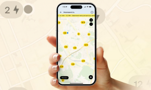
An interactive map of shelters has become available in the Diya mobile application, with which you can get directions to the nearest safe place and notify you if the shelter is closed. This was reported by the press service of the Ministry of Digital Transformation.


► Read telegram channel “Ministry of Finance”: main financial news
“A map of shelters has appeared in the application, now every Ukrainian during an air raid can quickly find the nearest safe place, view information about it and get directions,” – says the message.
How to find the nearest shelter in “Die”
- log in to the application; click on the “Inviolability” section; select category – “Ukrittya”; Click the – filter button if you want to specify the required parameters. For example, you are looking for shelter for people with disabilities; Select the desired shelter on the map, view information about it and get directions.
On the interactive map you can:
- see the type, rating and photo of the shelter, find out how many people it accommodates, evaluate the condition of the shelter, leave a review, report if it is closed, this information will be transmitted in OVA, share the location with relatives or friends.
The map of shelters works offline
In order not to depend on the Internet and connection, you can download a map of your area and it will always be available offline. To do this, you need to go to the “Unbreakable” section and click “Zavantazheni mapi”.
The card will be unavailable in four regions
For security reasons, the card will be unavailable in Donetsk, Luhansk, Zaporozhye and Kherson regions.
“But you can find out their addresses from local authorities,” the Ministry emphasized.