

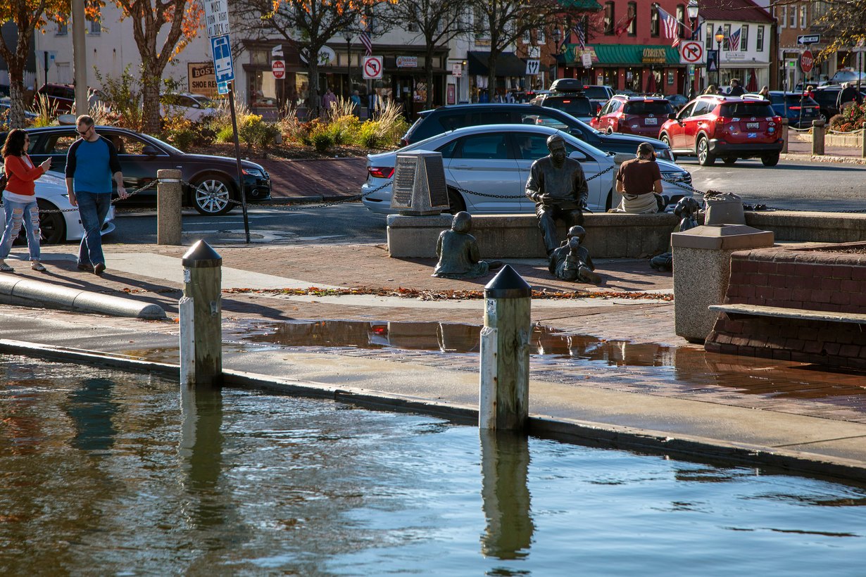
The National Weather Service has issued a coastal flood watch for the Anne Arundel County shoreline from 3 p.m. to 11 p.m. Sunday, Oct. 11, warning that moderate tidal flooding is possible in Annapolis around the evening high tide. If you park, work or live near City Dock, Dock Street or Compromise Street, Sunday evening is the window to plan around.
The watch, issued at 1:41 a.m. Saturday by the NWS Baltimore/Washington office, says up to one foot of water above ground level is possible in low-lying areas. It arrives as the remnants of Hurricane Isaias spread rain, gusty wind and a chance of severe storms across Maryland on Sunday.
Why is Annapolis under a coastal flood watch Sunday?
Three things line up at once, according to the forecast discussion the weather service published late Saturday morning. Strong onshore winds are expected during the highest of the day’s two tides, and that tide falls near the new moon, when tides already run higher than usual. Together they are expected to push a surge of water up the Chesapeake Bay and the tidal Potomac.
“Widespread tidal flooding is likely during the Sunday afternoon to evening high tide cycle.”
National Weather Service Baltimore/Washington, Area Forecast Discussion, Oct. 10, 2026
The same discussion says minor tidal flooding is expected at most of the office’s forecast locations, while Annapolis is singled out for a watch because moderate flooding is possible there. Forecasters expect water levels to drop quickly Monday morning as winds turn offshore.
The wind setup comes from the interaction between what is left of Isaias, moving north toward the Tennessee Valley, and high pressure sliding off the New England coast. Our earlier look at how Isaias’ remnants will affect Baltimore covers the rain side of the storm.
How high will the water get at City Dock?
The weather service’s tide forecast for the Severn River at Annapolis shows the Sunday evening high tide as the only cycle reaching flood stage. It is forecast at 3.4 feet above mean lower low water (MLLW), just above the 3.3-foot threshold for moderate flooding.
| High tide (approx.) | Total tide, ft MLLW | Above normal, ft | Flood impact |
|---|---|---|---|
| Sat., Oct. 10, ~5 a.m. | 1.8 | 0.4 | None |
| Sat., Oct. 10, ~6 p.m. | 2.2 | 0.5 | None |
| Sun., Oct. 11, ~6 a.m. | 2.1 | 0.7 | None |
| Sun., Oct. 11, ~6 p.m. | 3.4 | 1.7 | Moderate |
| Mon., Oct. 12, ~5 a.m. | 2.3 | 1.1 | None |
| Mon., Oct. 12, ~7 p.m. | 1.7 | 0.0 | None |
What does 3.4 feet mean on the ground? The weather service’s impact statement says that at 3.2 feet, water begins to approach businesses on Dock Street, the City Dock parking lot floods and Compromise Street floods. Sunday’s forecast sits slightly above that level, so those spots are the ones to watch.
Forecast numbers can shift by a few inches either way as the wind forecast changes, and the weather service could upgrade the watch to a warning, downgrade it to an advisory or drop it as Sunday approaches.
When is the worst of the flooding expected?
The watch runs from 3 p.m. to 11 p.m. Sunday, with the highest water expected around the evening high tide, which the forecast places near 6 p.m. Flooding from a tide usually builds in the hours before high water and recedes in the hours after, which is why the watch covers an eight-hour window rather than a single moment.
Monday morning’s high tide is forecast at 2.3 feet, below the minor flood threshold of 2.6 feet, and Monday evening’s tide is forecast to return to normal.
What about Baltimore and the rest of Maryland?
As of Saturday morning, Anne Arundel County was the only Maryland shoreline under a coastal flood watch. The forecast discussion’s mention of minor tidal flooding at most forecast locations means low spots elsewhere on the Bay could see water on Sunday evening too, and additional advisories are possible.
The bigger concern for much of central Maryland is rain and storms. The weather service increased its rainfall forecast to 1.5 to 2.5 inches, with locally 3 to 4 inches possible, but had not issued a flood watch as of Saturday morning because the heaviest rain was expected in areas that can handle it. Forecasters also flagged a few-hour window Sunday afternoon when thunderstorms could produce tornadoes and damaging gusts, mainly east of the Blue Ridge. The Storm Prediction Center had a marginal risk of severe weather extending north to the Maryland-Pennsylvania line.
In far western Maryland, a wind advisory covers western Garrett County from 8 p.m. Saturday to 11 a.m. Sunday.
Is tidal flooding becoming more common in Annapolis?
Annapolis has dealt with repeated high water this fall. The weather service issued coastal flood watches for the Anne Arundel shoreline in late September, and the same Dock Street and City Dock impact language appeared then. On Sept. 27, FOX45 reported flooding at City Dock during another watch.
The City of Annapolis flood page identifies the lowest-lying land in the city as the downtown City Dock area and Eastport, near the mouth of the Severn River, Annapolis Harbor and Spa Creek. Those neighborhoods typically see water first.
What should Annapolis drivers and residents do?
- Move vehicles early. The City Dock lot is among the first places to flood. Moving a car before mid-afternoon Sunday avoids the risk of returning to standing salt water.
- Allow extra travel time. The weather service warns that some roads may be closed around high tide.
- Do not drive around barricades or through water of unknown depth. Tidal water can hide curbs and drop-offs, and salt water is especially hard on vehicles.
- Protect flood-prone property. Businesses and homeowners near Dock Street and Compromise Street should move goods and equipment off the floor before the afternoon.
- Check for updates. The watch could change Saturday night or Sunday morning. The latest is posted at weather.gov for Annapolis.
Featured image: High water at the end of Spa Creek in downtown Annapolis during an earlier tidal flood, November 2021. Photo: Acoterion / Wikimedia Commons, CC BY-SA 4.0.